Entry044
En-Vau, the deepest cut
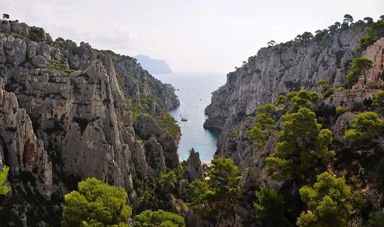
A narrow calanque in the commune of Cassis, En-Vau is framed by high cliffs and reached by path or sea. Its small beach sits at the end of the cut.
- Place
- Calanque d'En-Vau
- From the Quai des Belges
- about 25 km east, by road to Cassis
 Photograph: Tobi 87 — CC-BY-SA-3.0
“No road reaches En-Vau.”
1. The narrow inlet
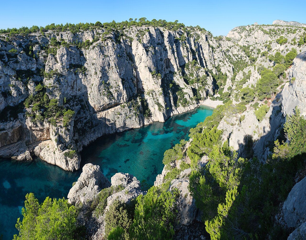
The Calanque d'En-Vau lies in the commune of Cassis, east of Marseille. It is one of the narrowest of the calanques. The sides draw close around the water; the cliffs rise well over a hundred metres above it. There is not much room between the rock walls and the sea. The calanque is more than the beach at the end of a route. It is also the steep passage leading there, with close-set edges.
From above, the long-distance coastal trail between Marseille and Cassis passes over En-Vau. The trail gives a different view: a cut through the cliffs, rather than a beach waiting at the bottom. I find that a useful way to hold the whole place in mind.
2. A rock with a name
A tall rock needle above En-Vau is known as the Doigt de Dieu, the Finger of God. The name marks a distinct point among steep faces and narrow lines. The cliffs remain the main feature: the water sits beneath them, and the small beach becomes clear against all that height.
Aleppo pines cling to ledges on the cliffs. They are part of the same vertical arrangement: rock face, ledge, trees, then the drop towards the water. The eye returns to the contrast between the narrow floor and the high sides.
3. By path or sea
No road reaches En-Vau. Access is by paths or from the sea. From Port-Miou, a path passes the Calanque de Port-Pin on the way to En-Vau. Another way descends from the Col de la Gardiole through a steep gully.
One route passes another calanque; the other comes down through a steep cut in the ground. Both lead to a small beach at the end, enclosed by cliffs. The final approach is on foot, or from the sea.
 Photograph: kallerna — CC-BY-SA-4.0
4. The descent
The route from the Col de la Gardiole descends through a steep gully. The path from Port-Miou passes the Calanque de Port-Pin before reaching En-Vau. I prefer the wider view of the landscape in that second description: one calanque leading to another, rather than each as a separate stop.
The beach is not a roadside opening but the end of a narrow inlet, hemmed in by cliffs. Arrival belongs to the contours of the land.
5. The small beach
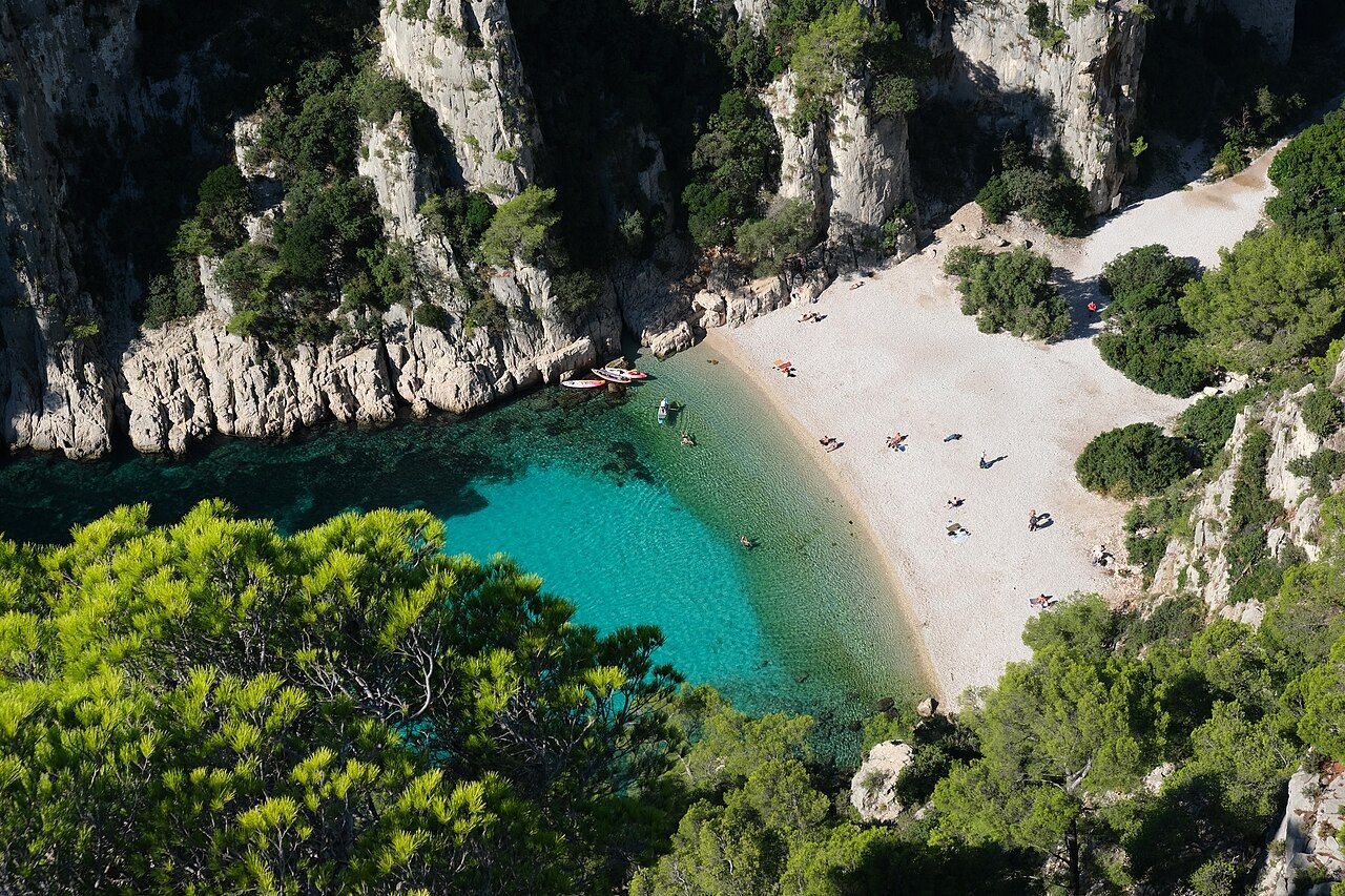
En-Vau ends in a small white pebble beach. It is a modest strip beside the scale of the cliffs, and its whiteness continues below the water. The white floor gives the water its deep turquoise colour.
The sea fills the narrow space between the cliffs and covers the pale floor. The beach marks the end of the inlet, but the water carries the same line onwards. I prefer the view in which the white shore and turquoise water read together.
The white floor gives the water its deep turquoise colour.
6. The wall
The walls of En-Vau have been climbed since the early 20th century. Their height frames the water below; the walls have also been a place for climbing over a long span of time. The vertical faces that define the narrowness of the calanque are its climbing terrain.
 Photograph: kallerna — CC-BY-SA-4.0
From the beach, the walls rise above the water. From the long-distance coastal trail, the route passes above En-Vau. The angle changes, but the cliffs make the place legible from either level.
7. The neighbouring calanques
Port-Miou belongs in the approach story as part of a path that passes the Calanque de Port-Pin on its way to En-Vau. The long quarry calanque by Cassis offers a point of comparison: the long quarry calanque by Cassis is different from En-Vau's narrow cut between high cliffs. Sormiou belongs in the wider conversation about the calanques, though its details are outside this account.
8. Holding the view
En-Vau is a narrow calanque in the commune of Cassis, with cliffs well over a hundred metres high, Aleppo pines on ledges, a tall rock needle above, and a small white pebble beach at the end. The water turns deep turquoise over the white floor. There is no road to the shore; the approaches are by path or sea.
The coastal trail passes above, one path comes from Port-Miou by way of Port-Pin, and another descends from the Col de la Gardiole through a steep gully. My preference is for the view that keeps the water and the enclosing cliffs in the same frame.
| Fact | Detail |
|---|---|
| Location | Commune of Cassis, east of Marseille |
| From the port | About 25 km east, by road to Cassis |
| Access | By paths or from the sea; no road reaches En-Vau |
| On foot | From Port-Miou via the Calanque de Port-Pin, or down from the Col de la Gardiole |
| Coastal trail | The long-distance trail between Marseille and Cassis passes above En-Vau |
I like En-Vau best as a line of cliff and water held close together.