Entry018
The ring of hills
A harbour-side sequence for naming the limestone ridges that shape Marseille’s bowl, from its western opening to the hills south of the city.
- Place
- Marseille
- From the Quai des Belges
- skyline from the quays
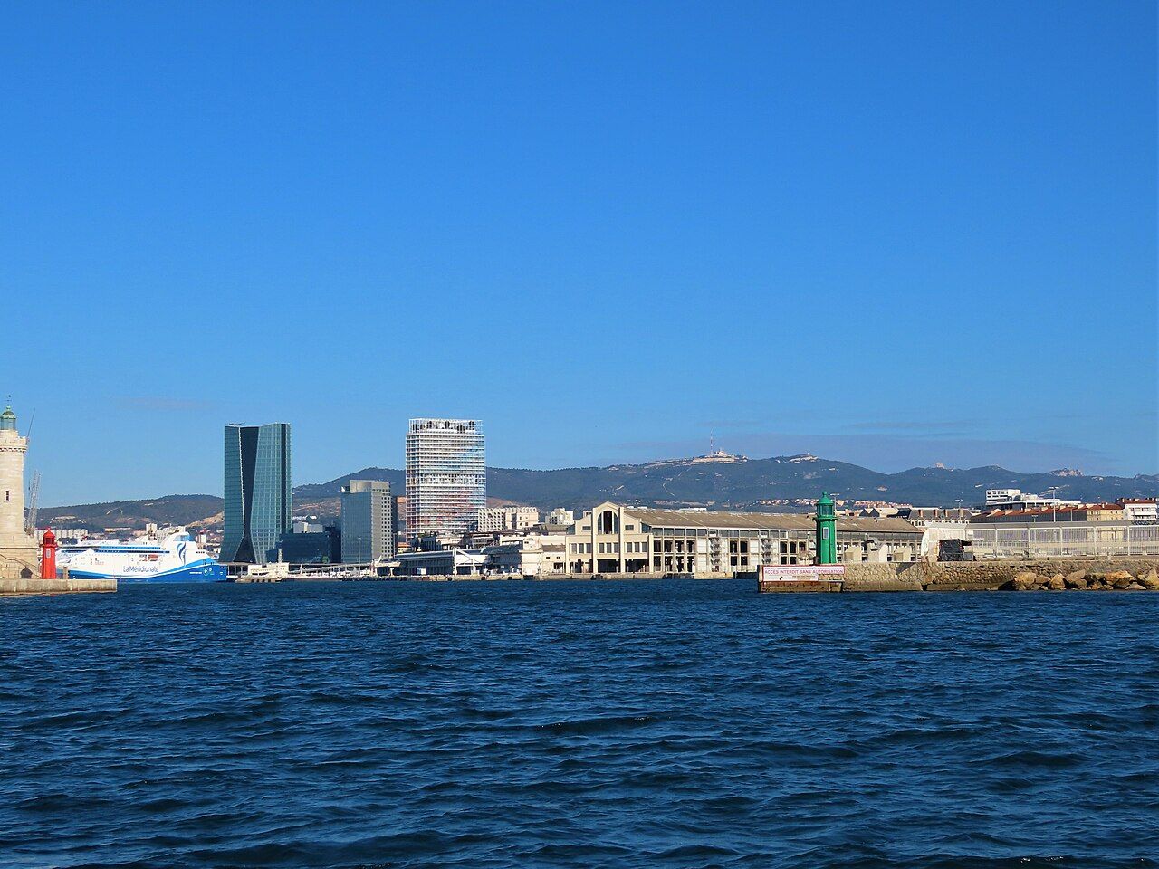 Photograph: Rémih — CC-BY-SA-4.0
“opens to the sea on the west”
1. Begin at the western opening
From the quays, start with the whole bowl rather than trying to name every rise at once. Marseille lies among limestone hills, with an opening to the sea on the west. Hills close the city on three sides, while the west remains open.
2. Turn to the north-west
On the north-west side, name the Chaîne de l'Estaque. It closes the bay of Marseille in that direction. Keep the name attached to the bay, not to the whole north; the next ridge has its own place. This distinction makes the skyline less like a row of anonymous bumps and more like a sequence of boundaries.
3. Follow the northern ridge
The Massif de l'Étoile rises along the city's north. Set it apart from the Chaîne de l'Estaque, which closes the bay to the north-west. From the quays, match each name with its position, then let the outline settle into memory.
4. Pick out the eastern landmark
East of the city, above Aubagne, stands the Garlaban, about 715 metres high. Marcel Pagnol was born in Aubagne in 1895 and wrote of the Garlaban hills in his childhood memoirs. Those details give the ridge a presence in the view: a place-name, a height and a literary association, without forcing the skyline into a perfect circle.
5. Close the bowl towards the south
Move round to the south-east for the Massif de Saint-Cyr, which closes the bowl of Marseille on that side. Further south, the Massif de Marseilleveyre and Mont Puget rise above the calanques. The names come in a close group here, so take them one at a time: Saint-Cyr at the south-east edge, then Marseilleveyre and Mont Puget farther south.
The Massif de Marseilleveyre and Mont Puget rise above the protected coast south of the city.
6. Compare the names with the wider view
Much of the ring of hills can be seen at once from the terrace of Notre-Dame de la Garde. Use that view to check the order you have built from the quays: the north-west, the north, the east, then the south-east and south. It is a useful way to hold the bowl together in the mind, without pretending every ridge has the same shape or weight. My preference is for naming the hills slowly; the outline becomes clearer that way.
| Position | Ridge or landmark |
|---|---|
| North-west | Chaîne de l'Estaque |
| North | Massif de l'Étoile |
| East | Garlaban, above Aubagne |
| South-east | Massif de Saint-Cyr |
| South | Massif de Marseilleveyre and Mont Puget |