Entry001
The Lacydon: the inlet beneath the Vieux-Port
The Vieux-Port follows the shape of an older inlet. Its quays and the finds made nearby give the harbour a longer working history than its present basin suggests.
- Place
- Vieux-Port
- Arrondissement
- 1st, 2nd and 7th
- From the Quai des Belges
- you are on it
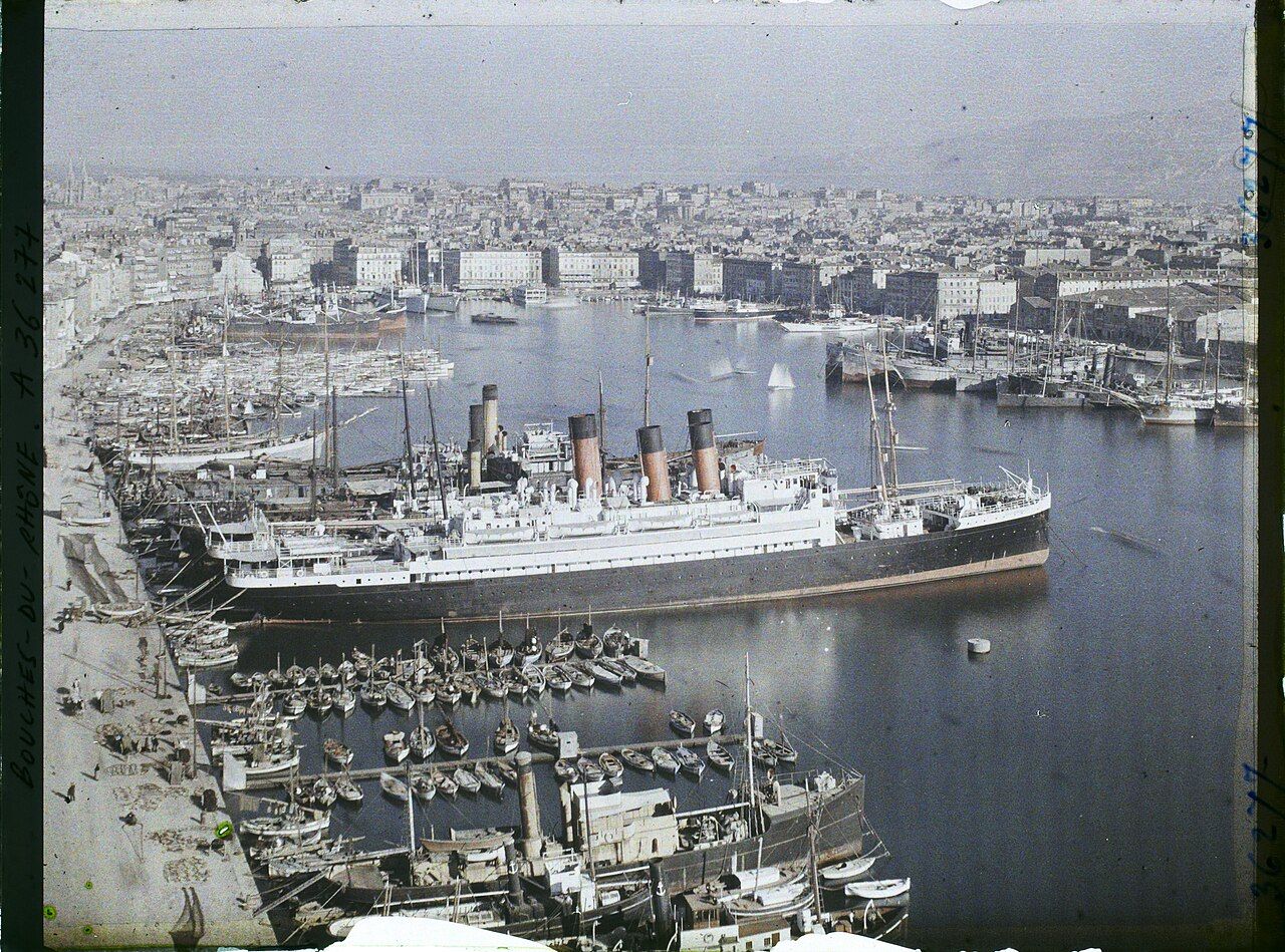 Photograph: Gadmer Frédéric — CC-BY-SA-4.0
1. What shape did the first harbour leave behind?
The Vieux-Port is what remains of the Lacydon, the deep inlet on whose north shore Greek settlers from Phocaea founded Massalia around 600 BC. The name belongs to a larger shape than the harbour seen now: the inlet once reached further inland than the present quays. The modern basin is a remnant, not the whole of that older waterway.
The basin runs roughly east to west and is close to a kilometre long. Those are useful proportions to keep in mind. The harbour is not a broad circle, but a long stretch held within a defined mouth, with quays following its sides and head.
2. A mouth held between two forts
The harbour mouth lies between Fort Saint-Jean on the north side and Fort Saint-Nicolas on the south side. Their positions make the entrance a clear part of the inlet’s shape: a narrow opening between two named points, then a basin running inland. The forts frame that mouth; the water beyond them belongs to the Vieux-Port.
The north side is the Quai du Port. Opposite it, on the south side, is the Quai de Rive-Neuve. At the head of the harbour is the Quai des Belges. Three names, set against three edges. I find that arrangement easier to read on foot than on a map: head, north side, south side.
3. The quays and the older shoreline
The basin is the part of the Lacydon that remains as a harbour, but the former inlet ran further inland. That difference matters when looking at the old port as a landform. The quays show the present outline; the older water reached beyond it. The city’s built edge does not mark the full extent of the inlet that gave Massalia its site.
Behind the Bourse, excavations in 1967 uncovered part of the ancient harbour and its quays. The find gives a physical trace of that earlier harbour in the city, beyond the present water’s edge. The Greek walls still showing in a sunken garden put the older settlement in view alongside the ground around the port: the Greek walls still showing in a sunken garden.
4. What the boats preserve
Digs at the Place Jules-Verne in 1992 and 1993 found the remains of several ancient boats, including Greek vessels of the 6th century BC. Boats preserve a form of evidence distinct from a quay. A quay marks an edge where people used the harbour; a boat carries the form of the work itself, preserved as remains rather than as a view of the water.
The finds do not turn the present basin into a complete picture of the ancient inlet. They add specific points to it: part of the ancient harbour and its quays behind the Bourse, and several boats at the Place Jules-Verne. The account stays more convincing when those places are kept distinct, rather than blended into one imagined shoreline.
5. Digs in a changing city
Rescue digs before building work in central Marseille are carried out by Inrap, France's national institute for preventive archaeology, and by the city’s own archaeology service. The work brings archaeology into the same ground where the city continues to build. In this part of Marseille, the older harbour is a story attached to the water, and its remains have also been found during work on land.
That connection is straightforward. A building project can prompt a look below the present surface, and what turns up can add a harbour edge, a quay or a boat to the record. The finds named here are specific, and they are enough to show why the inlet’s older extent cannot be read from the current quays alone.
6. A working port, then a new scale
Until the mid-point of the 19th century, the Vieux-Port was Marseille’s only commercial harbour. Its working role lasted into a period when the size of ships became a problem for the old basin. Work on new docks at La Joliette, north of the old harbour, began in the 1840s because ships had grown too big for the Vieux-Port.
The change was one of scale. The old inlet continued to shape the harbour, but it could no longer serve every commercial ship. La Joliette’s new docks mark a response to that limit, not a replacement of the inlet’s place in the city. The older harbour remained, with its long basin and the quays along its sides.
7. The basin now
Today the Vieux-Port basin holds mostly pleasure craft and a small fleet of local fishing boats. Those boats make the harbour’s working character visible in a different way from the commercial traffic it once served. The present mix is modest beside the role of the port in Marseille’s earlier commercial life, but fishing remains part of what the basin holds.
The basin is the surviving shape of an inlet that once ran further inland.
The basin is the surviving shape of an inlet that once ran further inland.
I keep returning to the harbour’s long east-to-west line. The quays and the forts make that outline legible, while the excavated boats and harbour remains show how much of its history lies beyond the water visible now.
8. A line to follow
Metro line 1 has a station called Vieux-Port, close to the foot of the Canebière. From there, the basin’s shape is the useful thing to hold on to: the mouth between Fort Saint-Jean and Fort Saint-Nicolas, the north and south quays, and the head at the Quai des Belges. The names give a simple way to orient the present harbour without mistaking it for the full Lacydon.
I prefer the port read as a long inlet with an older reach inland, rather than as water bounded only by today’s quays.
| Arrondissements | 1st, 2nd and 7th |
|---|---|
| From the port | You are on it |
| Metro | Line 1, Vieux-Port station, close to the foot of the Canebière |