Entry045
Port-Miou and the stone of Cassis
A day along the longest calanque, where hundreds of boats share the inlet with the marks of a quarry that closed after years of protest.
- Place
- Calanque de Port-Miou
- From the Quai des Belges
- about 25 km east
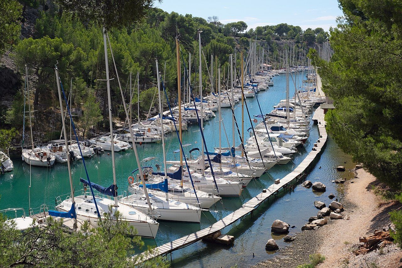 Photograph: kallerna — CC-BY-SA-4.0
One. “the longest of the calanques”
Morning at Port-Miou begins with small boats moored along a long inlet. The Calanque de Port-Miou lies just west of Cassis. It is the longest of the calanques, running for about one and a half kilometres. The boats make the length easy to read. Not a single view to take in and leave behind, but a working stretch of water with a line of moorings beside it. Port-Miou has a different character from the broad beach calanque on the Marseille side: its boats run along the inlet.
Two. Along the water
Hundreds of small boats are moored along the length of Port-Miou. From beside them, the inlet reads less like a gap in the coast than a place used every day. The water holds the boats; the land presses close along either side.
Port-Miou lies in the commune of Cassis, in the Bouches-du-Rhône. That is a compact location for a place whose stone travelled much further. The hard, pale limestone of Cassis was used for quays and buildings around the Mediterranean. Here, the source sits beside the water it helped build around.
Three. The quarry side
As the walk continues, the quarry comes into the account. A limestone quarry on the side of Port-Miou was worked until 1982. The hard pale stone is not a decorative detail added to the inlet; it is part of its working history. Thinking of it in quays and buildings around the Mediterranean gives the place a wider reach, though the quarry itself belongs to this particular side of Cassis.
Four. The year it stopped
The quarry closed in 1982, after years of protests by people who wanted the calanques protected. That sequence matters: years of argument, then an end to the work. The boats still line the inlet, and the quarry remains part of what the place is. Port-Miou is not easily reduced to a quiet natural scene. Its present use and its extraction history sit together, with no need to tidy one away to understand the other.
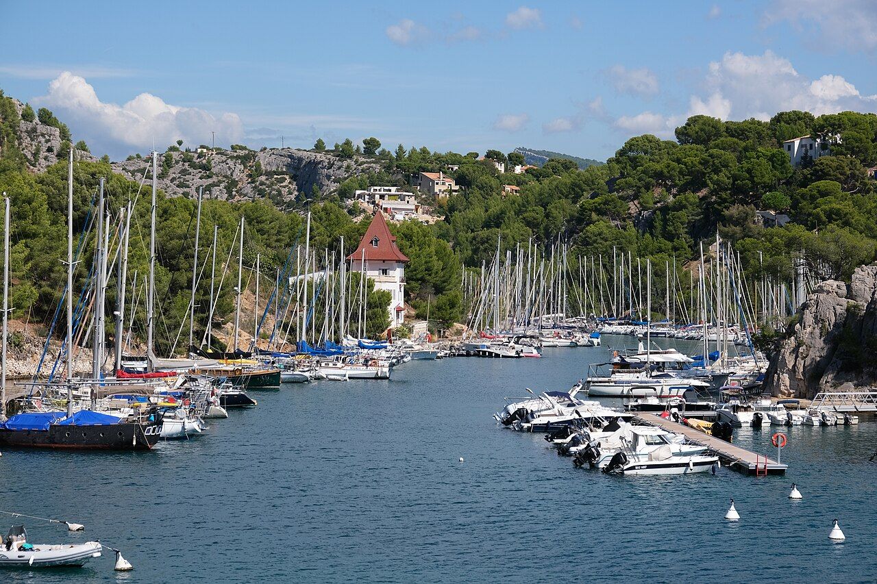 Photograph: kallerna — CC-BY-SA-4.0
The contrast is plain. A mooring is a working use of the water; quarrying was a working use of the slope. One continues, while the other ended after protest. I find the inlet more legible when both are kept in view, rather than treating the boats as the whole story or the quarry as a footnote.
Five. Water from below
Near the mouth of Port-Miou, a large freshwater spring rises from under the sea floor. The source is out of sight, beneath the water, but it belongs to the same inlet as the boats and the old quarry. Cave divers have explored the flooded galleries behind the spring for decades. There is a hidden system behind the visible line of the coast, though the useful fact is simple: fresh water rises here from below.
Six. The path onward
By the end of the day, Port-Miou has offered more than a starting point for a walk. The coastal path to Port-Pin and En-Vau begins here. The broader route continues from an inlet with boats, quarry history and a spring under the sea floor. On the way out, the first impression changes a little: the boats still occupy the water, but the pale stone and the years of protest remain in the picture too. Port-Miou feels most complete as a working inlet with a past that nearly took it apart.
I prefer the walk with the quarry in mind; it gives the boats a sharper context.
| Port-Miou | Just west of Cassis; in the commune of Cassis, Bouches-du-Rhône. |
|---|---|
| Length | About one and a half kilometres; the longest of the calanques. |
| Quarry | Worked until 1982; closed after years of protests. |
| Coastal path | Begins at Port-Miou; continues to Port-Pin and En-Vau. |