Entry007
January 1943: the old quarter north of the harbour
A field note on the mass round-up, the dynamiting of about 1,500 buildings, and the few old structures left standing north of the harbour.
- Place
- Quai du Port
- Arrondissement
- 2nd
- From the Quai des Belges
- 5 minutes on foot
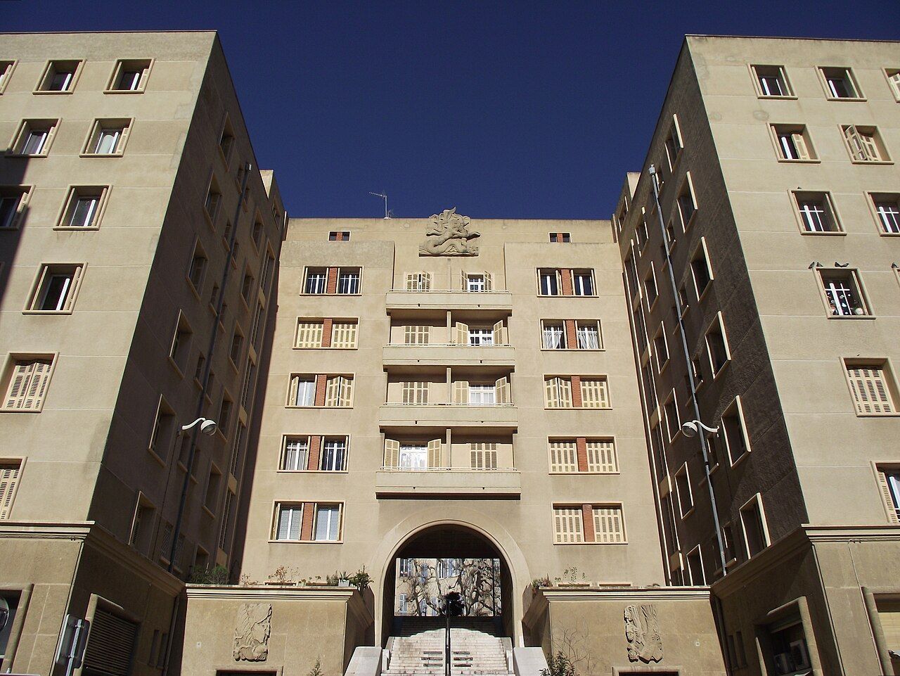 Photograph: Fred Romero from Paris, France — CC-BY-2.0
“What was lost?”
1. 22–24 January 1943: the round-up
Between 22 and 24 January 1943, the German occupiers and the French police carried out a mass round-up in central Marseille. The old quarter north of the Vieux-Port was not only a collection of streets and buildings. It was also home to the people forced out of it. About 20,000 people were made to leave in January. That figure is difficult to hold in mind as a single number; the plain fact is that a whole neighbourhood was emptied by force.
The round-up and the destruction that followed belong together, but they were not the same act. People were driven from the quarter first. The dynamiting began later. Keeping that order clear matters: the cleared ground was not simply the result of buildings being demolished. It was a place from which residents had already been removed.
2. 20,000 people forced out
The scale of the expulsion makes a quiet map of the old streets feel incomplete. A map can mark the quarter’s position on the north side of the harbour, between the Quai du Port and the slopes of Le Panier. It cannot hold the sudden absence of the people who lived there. The old quarter is a convenient name for a place, but it should not make the removal sound neat or abstract.
3. 1,600 taken to Compiègne
Over 1,600 people were taken from Marseille to the camp at Compiègne during the January round-up. Several hundred Jewish residents caught in that round-up were later deported to the death camp at Sobibor. These facts sit within the same account of removal, but each carries its own weight. People were forced from their homes; some were transported to Compiègne; several hundred Jewish residents were later deported to Sobibor.
4. 1 February 1943: the dynamiting
From 1 February 1943, the German army dynamited about 1,500 buildings in the old quarter north of the harbour. The destroyed area covered about 14 hectares, between the Quai du Port and the slopes of Le Panier. A broad stretch of the city was thus changed after its residents had been driven out. The numbers describe extent, not experience, but they give the loss a scale that a few surviving façades cannot.
The list of survivors is short; the loss was measured across about 14 hectares.
The list of survivors is short; the loss was measured across about 14 hectares.
5. About 1,500 buildings: the measure of loss
Among the few old buildings left standing were the Hôtel de Ville, the Maison Diamantée and the Hôtel de Cabre. The surviving buildings are not a substitute for the quarter that was destroyed. They are points of continuity within a much larger break. The Hôtel de Ville is one of those points; Pouillon's stone frontage on the quay gives that name a place on the harbour edge.
The Maison Diamantée, on the Rue de la Prison, takes its name from its façade of stones cut into diamond points. The Hôtel de Cabre was built in 1535 and is one of the oldest houses in Marseille. I find it useful to hold these specifics beside the scale of destruction: a name, a street, a façade, a building date. They do not restore what was lost, but they keep the surviving parts from becoming anonymous.
6. 14 hectares: the cleared ground
Digging for the rebuilding of the quarter after the war brought Roman and Greek remains to light. The ground held evidence from earlier periods as well as the record of what had just been demolished. There is a hard contrast in that fact: rebuilding disturbed the earth, and the work revealed older remains. It is worth keeping the two parts together without making the discovery sound like a compensation for the destruction.
The departmental archives of the Bouches-du-Rhône hold photographs and files on the evacuation and destruction of 1943. Photographs and files preserve a record of the evacuation and demolition, not the quarter as it was lived in.
7. 1535: a house turned
In 1954 the Hôtel de Cabre was lifted and turned in one piece to line up with the rebuilt street plan. It is a strikingly practical survival: the house remained, while its position was changed to fit the new arrangement. That detail makes the rebuilt quarter legible as more than a simple return to what came before. Even a building that survived was made to meet a different street plan.
8. 1954: the rebuilt street plan
The quarter north of the Vieux-Port is remembered through several kinds of evidence: the people forced out, those taken to Compiègne and deported to Sobibor, the buildings dynamited, the few structures left standing, and the photographs and files held in the departmental archives. The Roman and Greek remains brought to light during rebuilding add another layer beneath the later streets. None of these records is the whole quarter. Together, they make its loss harder to reduce to a change on a map.
I prefer the account that keeps the human expulsion beside the physical destruction. The surviving buildings matter, and so does the fact that they were few. The place is easier to understand when neither is allowed to stand in for the other.
The surviving houses are worth pausing over, but the absence around them is the stronger fact.
| Place or record | What remains in the account |
|---|---|
| Old quarter north of the harbour | About 14 hectares between the Quai du Port and the slopes of Le Panier |
| Hôtel de Cabre | Built in 1535; turned in one piece in 1954 |
| Archives | Photographs and files on the evacuation and destruction of 1943 |